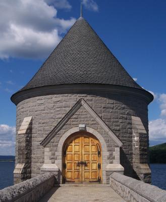
This is the grand entrance to the gatehouse of the Saville Dam in Barkhamsted, CT (photo by Bill Owens) that controls the water going down to the lake below the dam. And there is something surreal about this photo. In a B/W photo of 4/12/2004 by the photographer Aaron Bieber there are quite a number of differences to be observed, from the stones on the bridge, to the detail of the wood and even the lamp above the door.
This dam was completed in 1940 on the East Branch of the Farmington River. It is named for the chief engineer of the project, Caleb Mills Saville. The Barkhamsted Reservoir is about 8 miles long and extends from central Barkhamsted north into the town of Hartland almost to Massachusetts. The Reservoir is the primary water supply for the metropolitan Hartford area, which is about 25 miles away. Many Barkhamsted farms, houses and the village of Barkhamsted Hollow were located in the area now flooded by the Reservoir.


<< Home